This article is a comprehensible summary of my master thesis. You can find the full scientific report here.
Thunderstorms are responsible for billions of euros of damage yearly for European countries as they are sometimes paired with heavy rainfall, lightning, hail and extreme wind gusts. Some scientists argue that climate change will increase the likelihood of severe thunderstormsin Europe. Most research agrees that in particular the associated rainfall will become more intensein the future. There is less consensus on and research into the fate of extreme wind gusts from thunderstorms. This is nonetheless an important topic to study, as we need to plan accordingly. For example, it is important to know if wind turbines are strong enough for future wind speeds and whether we need to strengthen our dikes. In my thesis I used climate and weather models to study whether wind gusts from thunderstorms will become more extreme and frequent in the future, and this indeed seems to be the case. But how do thunderstorms generate extreme gusts? Why are they so difficult to predict? Is it even possible to make a weather forecast for 2097?
Convective clouds
On a warm summer day you can often see cumulus clouds. These fall into the category 'convective clouds', as they are formed through the process of convection. This physical process describes the process in which warm air or water rises.
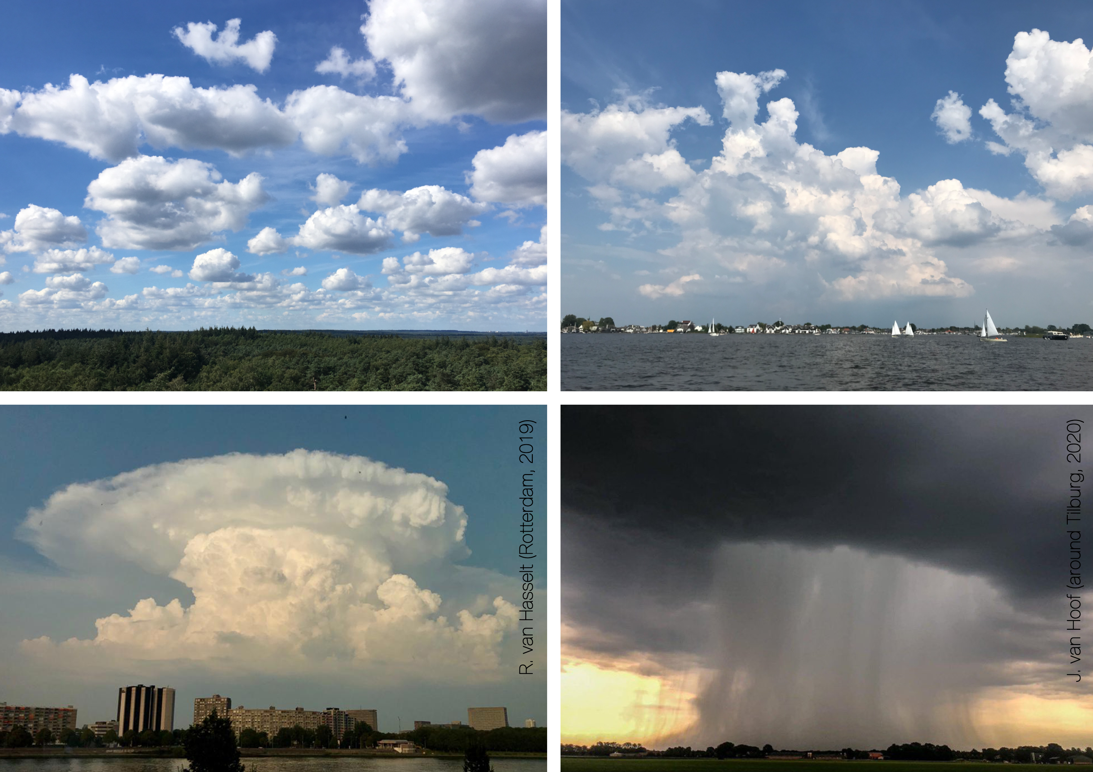
The rising air usually contains water, and as a rule thumb, cold air can contain less water than warm air. When the air rises and cools, it will become saturated with water. At this point, condensation takes place: droplets of air and sometimes ice crystals are generated to form clouds. When the air rises rapidly, contains a lot of water or when the air is very unstable,the clouds can form up to high altitudes to form cumulonimbus clouds.
Downdrafts and wind
At some point the water droplets and ice crystals are too heavy to stay up by the convective updrafts and will start falling. The descending water droplets drag the surrounding air along downwards. The downgoing air flow is called a downdraft or downburst. Once the downdraft reaches the surface it is deflected parallel to the Earth. This causes a gust front, that is perfectly illustrated by the video below.
Some meteorological conditions allow for more extreme gusts from thunderstorms than others. Two important ingredients for severe gusts are strong wind shear, the difference in wind speed and direction between the surface and higher altitudes, and instability of the atmosphere. Some circumstances even allow for the genesis of tornadoes.
Indispensable weather models
To make forecasts and to issue severe weather alarms weather models are indispensible. In a weather model the Earth is divided into cells. Mathematical equations are applied between those cells to compute how the weather develops. Initial conditions are taken from observations from satellites, ground stations and weather balloons. Unlike winter storms, thunderstorms are often local: usually they are not bigger than a few kilometers. This makes them extra difficult to capture in weather models, and for this reason, a weather forecasts in summer are on average worse than in winter. In the operational weather model of KNMI, called Harmonie, the cells are 2.5 km x 2.5 kmin size. With this resolution it is possible to capture large thunderstorms.
Climate scenarios
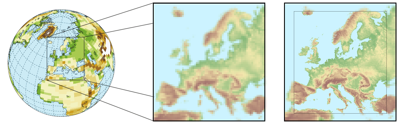
As the cells of Harmonie are relatively small the calculations are computationally expensive. For this reason, weather forecasts with Harmonie only go up to two days into the future. Climate studies require models to look decades or even centuries ahead and hence need alternative models. These models are called ‘global climate models’, often abbreviated to GCMs. Such models have grid sizes of around 80 x 80 km. Due to this coarser resolution the calculations are less intense and can be done for the entire 21st century. In such models the CO2 concentration is altered using various scenarios.The output of GCMs can be used to investigate what will happen to the average global temperature when the atmsopheric carbon concentration is increased. However, at the 80 x 80 km kilometer scale it is challenging to study small scale weather phenomena, like thunderstorms. Here the high resolution model Harmonie comes in handy again. The GCM data are downscaled using Harmonie in Europe. This means that boundary conditions are taken from the GCM in stead of observations.
This is rather unique. Until now, most research using climate models has been done by using GCM output directly or by using coarser weather models. Therefore, it was challenging to study weather phenomena such as thunderstorms. As my thesis uses data from a high resolution model for the first time to study gusts in a warming climate, I also studied whether extreme wind gusts are accurately represented in the model, and the performance seems to be reasonably good.
Thunderstorm June 29th 2097
In the animation below, one of the results from my thesis, you can see how a thunderstorm on the 29th of June 2097 develops in the Netherlands. The day commences with high temperatures, locally up to 45°C. As a consequence, the instability (as measured by 'CAPE' in the animation) is also high. In addition, the wind shear is strong, with speeds up to 40 m/s locally. Strong wind shear in combination with high instability is the main ingredient for the formation of extreme gusts from convective storms. Indeed, around 15:30 strong gusts occur with speeds up to 45 m/s. By looking at the temperature field you can see cold cells popping up. Such regions are called cold pools, and are generated by cold air descending from above. In turn, this exchange of air with higher levels is captured by the vertical wind field, in which up- (positive speeds) and downdrafts (negatieve speeds) are visible. A storm with similiar characteristics is unimagineable in the current climate.
Will gusts from thunderstorms become more extreme in Europe in the future?
To address this question I compared the model's data from a historical period (1996-2005) with a future period (2090-2099). The results indicate that little will chance with the average wind gust in Europa. However, the results show significant changes for extreme wind gusts in summer.The left figure below shows the maximum summer wind gusts in the model run of Harmonie in history (1996-2005). The right image shows how the maximum wind gust changes in the future (2090-2099) relative to history.
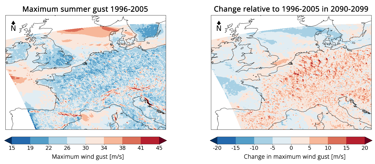
Noticably, the maximum speed increases with up to 20 m/s in some locations, especially in the east of the Netherlands and Germany. I made similiar figures for the number of summer days with gusts above 25 m/s. These figures shows that the frequency of summer days with extreme gusts will increase in the same regions as the maximum gust speed increases. Thunderstorms are local phenoma that not often produce severe gusts. Even in the future the number of summer days with gusts above 25 m/s is modelled to stay below 1 per year in non-coastal Europe when looking at a single grid point. This number is higher in mountainous regions, with around 10-20 per year per grid point. Due to the rare occurance of severe thunderstorms it remains challenging to draw robust conclusions from this modelled data alone. Besides, like every scientific research several uncertaintiescome paired with these results.
Despite these uncertainties my thesis shows that it is very important to continue research into extreme gusts in a future warmer climate. In addition, the results indicate that in such studies, the used weather and climate models can play an important role. This project is part of the KNMI climate scenarios. An important goal of these scenarios is to prepare society for the challenges that arise from the warming of the planet. I hope that my thesis and my future career will contribute to this goal.
Hopefully you enjoyed reading this article and learned something about wind, clouds and weather forecasts of the future. I couldn't have made this website without my kind, creative and supporting partner Thomas. In addition, I am very grateful to Andreas Sterl, Hylke de Vries and their KNMI colleagues and Sukanta Basu from the TU Delft for their guidance in conducting research and writing my thesis, and Dylan and Sandrijn for proofreading. Lastly I would like to thank my parents and family for their endless support for all my ventures. I look forward to hear if you have any questions or beautiful pictures of (thunder)clouds!